Valentine’s Day Week, February 2012

This was a long week starting with a busy School Board meeting on Monday night and events extending into this weekend. It turned out to be a life-changing week and my adventures will be posted in several installments here. For reasons I don’t understand, I didn’t take many pictures. There were so many interesting scenes I should have documented. I am gonna have to fire myself as my own documentarian!

Almost all this week revolved around Cotopaxi School stuff. As Jackie Gleason opened his show, “And awa-a-aay we go!”

Milky Way’s black hole grazing on asteroids

The title makes me think of a cow meandering about a field eating grass. The reality is a bit more violent! From Science Blog.

The giant black hole at the center of the Milky Way may be vaporizing and devouring asteroids, which could explain the frequent flares observed, according to astronomers using data from NASA’s Chandra X-ray Observatory.

For several years Chandra has detected X-ray flares about once a day from the supermassive black hole known as Sagittarius A*, or “Sgr A*” for short. The flares last a few hours with brightness ranging from a few times to nearly one hundred times that of the black hole’s regular output. The flares also have been seen in infrared data from ESO’s Very Large Telescope in Chile.

Zubovas and his colleagues suggest there is a cloud around Sgr A* containing trillions of asteroids and comets, stripped from their parent stars. Asteroids passing within about 100 million miles of the black hole, roughly the distance between the Earth and the sun, would be torn into pieces by the tidal forces from the black hole.

These fragments then would be vaporized by friction as they pass through the hot, thin gas flowing onto Sgr A*, similar to a meteor heating up and glowing as it falls through Earth’s atmosphere. A flare is produced and the remains of the asteroid are swallowed eventually by the black hole.

Planets thrown into orbits too close to Sgr A* also should be disrupted by tidal forces, although this would happen much less frequently than the disruption of asteroids, because planets are not as common. Such a scenario may have been responsible for a previous X-ray brightening of Sgr A* by about a factor of a million about a century ago. While this event happened many decades before X-ray telescopes existed, Chandra and other X-ray missions have seen evidence of an X-ray “light echo” reflecting off nearby clouds, providing a measure of the brightness and timing of the flare.

What they don’t mention is that many of these asteroids may be pieces of broken up planets.

Here is a neat simulation from Space.com.

And more on supermassive black holes.

Modern, low-energy ammunition can cause deep tissue damage

http://scienceblog.com/52017/modern-low-energy-ammunition-can-cause-deep-tissue-damage/

Specifically the article is talking about hollow point ammo in handguns. This type of ammunition is outlawed in combat with full metal jacketed rounds required but street fighters aren’t covered.

The point of the article is for ER docs to ensure that there is no deep tissue damage which will become life threatening later. And the term “low energy” is relative!

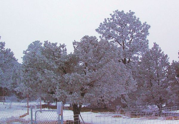
Frosty Morning

It is foggy and 17°.

And everything is covered in frost! Shortly after this light snow began. We still had a couple of inches of previous snow on the ground.

My 2/9 Cancer Update — Supplemental

I got a reply from one of my friends about my update:

Cancer does indeed take you to unexpected places – and to a meeting with unexpected people.

I found that the other cancer patients were hard to get to know. It’s as if no one wants to make a friend that might be taken away before you go. But even causal contact is interesting – if you can get them to open up – and if you can open up. Sharing your experiences – and your concerns – seems to lessen the burden somehow.

Something about happiness shared is doubled and grief shared is halved.

This reminded me of one thing that happened on Wednesday. While I was at a meeting before my trip to my urologist, Donna got a call from a friend who lives up the river a ways. Bob is an artist who lives in Coaldale and also has prostate cancer. He went a different route than I did, driving to Denver to University Hospital for treatment. Our treatment was entirely different; he had his prostate frozen with liquid argon.

But we have now reached similar places: recurrence. He is gonna get refrozen. I have no idea what I am gonna do. But we can go on and on about art (“Christo is coming!), politics (He makes me look like a moderate!); and local politics. He runs a blog about local politics.

But our connection is our cancer and how we are coping. We talked for an hour. We originally met over our volunteer fire department and have kept in touch. But he is the only fellow patient I know.

My Cancer Update

I went to see my urologist in Pueblo Wednesday. This Firmagon injection was only 80 mg; last month I got 2 120s.

This is the whole thing that the nurse laid out for the doctor.

I was surprised to see this was a powder. The vertical line is a reflection of the fluorescent light on the ceiling.

He squirted sterile saline into the vial and mixed it before he sucked the mixture back into the syringe. Then put it into my belly. I tried to take a picture of him injecting but my big belly got in the way! He is good; it was painless.

Then the nurse took a blood sample for a PSA analysis.

The doctor called me this afternoon and “fired” me as a cancer patient. He will continue as my urologist but wants me to find an oncologist. Because my PSA was 40!! Much higher in only two months from the 12.6 in December. I don’t blame him for bailing!

My GP said he knew an oncologist who practices at the Heart of the Rockies Hospital in Salida. So I called his office to get referred to the oncologist. I hope he is taking patients; he is supposed to be retired!

Sometimes this adventure takes me unexpected places.

Snow!

We had no snow in the forecast for today; tomorrow, yes. So we got 45 minutes of snow this morning around 7.
And again tonight starting at 6.

There is measurable on the ground and still falling as you can see. Our snow was supposed to start tomorrow afternoon.

My New Imus Map

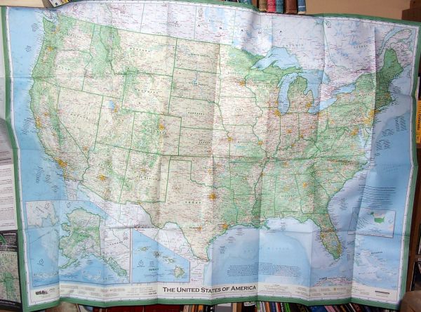
I don’t even recall how I heard about this map but I think it was on someone’s blog. It sounded cool so I bought one and I went to the back order list! The response was way more than his [unamed] supplier/publisher expected! Then I got the thing. It is huge: 4′ by 32″ for the actual map.

I suggest opening this image in a new window/tab and enlarging to full size. I made it deliberately large so you can see some detail on it.

Donna and I are still figuring out where to put this; we already have maps (world, US, CO, and NM) on our hall wall but this one takes as much room as all the others together!

Anyway, when I took it out of the envelop, this is what I saw.

The cartographer, David Imus, spent two years and 5000 (or 6000, depending whose telling the story!) hours creating this map. One wag referred to him as OCD which was my own first reaction! As he says,

Americans are notoriously oblivious about geography, says professional cartographer David Imus, and he’s on a mission to change that.

Imus, 53, blames the lack of knowledge partly on mapmakers, who largely manufacture two-dimensional, political maps.

And he is big on historical and other sites; I have never seen the Granada Internment Camp marked on a map before (eastern Colorado). Nor have I noticed the Northern Divide on a map; this is the place mostly along the US-Canadian border where rivers run north or south.

He even created his own color and other schemes to make it more readable and less cluttered.

This is Colorado and I found one error and one peculiarity. The error is where he put the name “Royal Gorge”; he doesn’t use arrows to indicate where the location is so this has “Big Horn Sheep Canyon” labeled as the Gorge. The Gorge is east (down river) of the location on his map.

But I am nitpicking. One interesting thing was the town name of Buena Vista just below the second “o” in Colorado. He could not bring himself to overlay the town name with the state name!

One thing I had to look up was “Great Sand Dunes NP & P”; when they created the National Park for the dunes, it was two things: the NP and the Preserve. The mountains east of the dunes is the preserve.

Oh, yeah, CDT stands for Continental Divide Trail. I had to look that one up, too!

This is an amazing map and well worth the money. They are caught up orders so get yours today at Imus’ website.

My Cell Phone Gently Beeps

My apologies to George Harrison for the title of this post.

Anyway, my cell phone was acting oddly this last week. Twice in the wee hours of the morning (2:39 and 2:40) I would wake to see my phone shining brightly for no apparent reason. And I had no reason to be awake then, either! There was no incoming text or call. Maybe my phone went out to play every morning and I just happened to wake up and catch it!

But the third time I wasn’t asleep at 11:20 when I heard a soft “beeep” and it came to life. And shortly went back to sleep! I lay there thinking who might be browsing my cell files: Verizon? Homeland Security? The FBI? A hacker?

The next day I waded through all the menus on the thing to see what might be happening. I found software updates turned on and no way to turn any associated alert sound off. I left it on and was relieved that Verizon was looking out for me! 🙂

I can’t tell any difference in how my phone works so whatever they fixed is invisible. And I haven’t had anymore “midnight flashes” either. I assume it is perfect now!

Snow Angel?

I was a bit tardy getting bird seed out this morning so the multitudes of Juncos were having to forage. There were tracks in the new snow as they sought weed and grass seeds. But this pattern stood out.

There were only tracks leading up to this point.

My theory is its right foot sank into the snow and its wings were used to lift it free. But it was still a cool pattern!

Over The River

We just had two hearings for our county in approving this massive ($50,000,000) art project. One hearing was in Canon City in the County Commissioner’s chambers and that one went on all day with between 150 – 200 people in attendance.

From the Salida Mountain Mail: Fremont Commissioners hear art project comments

From the Pueblo Chieftain: Economic boon

The second one was in Cotopaxi in the school’s Multi Purpose Room — the old gym, with about 80 in attendance in spite of an approaching storm.

From the Canon City Record: Local OTR hearings conclude. Also at http://www.themountainmail.com/news/article_9f337564-4dbe-11e1-8851-001a4bcf6878.html

From the Denver Post: Foes of Christo’s plan to drape over river make final stand .

Two news articles were more analytic.

From the Record: ‘Over the River’ Hearings Far From Over

And from the New York Times: Note to Christo: Don’t Start Hanging the Fabric Yet

More stuff:

Christos’ website with lots of artist sketches of the curtains.

and

ROAR’s website with lots of BS.

***********

The red areas are the locations of the curtains except for the one NE of milemarker 250 which is the staging area. This is in the Pinon Acres area as well as the BLM area across the river. On the right of the map is Canon City and the left is Salida.

The BLM Record of Decision page has more details.

I find this very entertaining. Except for the fact that Donna and I are opposite sides of this project! But this will make life more interesting up here!

Today’s Snow

We have a paltry 2″ while the Front Range is measuring in feet; 1-2′ is the rule down below.

Even the small tree is standing proud! Lol.

NASA: For the 100th time, it’s humans driving global warming, not the Sun!

I have some friends who are climate change deniers. Adamantly. I am unsure why nor would I expect this information to change their minds. But here is the most definitive study on the subject. OTOH, I am sure the “chemtrail” advocates will be using this information!

As I was writing this, an omen appeared in the sky outside my window.

A new NASA study underscores the fact that greenhouse gases generated by human activity — not changes in solar activity — are the primary force driving global warming.

The study offers an updated calculation of the Earth’s energy imbalance, the difference between the amount of solar energy absorbed by Earth’s surface and the amount returned to space as heat. The researchers’ calculations show that, despite unusually low solar activity between 2005 and 2010, the planet continued to absorb more energy than it returned to space.

James Hansen, director of NASA’s Goddard Institute for Space Studies (GISS) in New York City, led the research. Atmospheric Chemistry and Physics published the study last December.

Hansen’s team concluded that Earth has absorbed more than half a watt more solar energy per square meter than it let off throughout the six year study period. The calculated value of the imbalance (0.58 watts of excess energy per square meter) is more than twice as much as the reduction in the amount of solar energy supplied to the planet between maximum and minimum solar activity (0.25 watts per square meter).

According to calculations conducted by Hansen and his colleagues, the 0.58 watts per square meter imbalance implies that carbon dioxide levels need to be reduced to about 350 parts per million to restore the energy budget to equilibrium. The most recent measurements show that carbon dioxide levels are currently 392 parts per million and scientists expect that concentration to continue to rise in the future.

Climate scientists have been refining calculations of the Earth’s energy imbalance for many years, but this newest estimate is an improvement over previous attempts because the scientists had access to better measurements of ocean temperature than researchers have had in the past.

The improved measurements came from free-floating instruments that directly monitor the temperature, pressure and salinity of the upper ocean to a depth of 2,000 meters (6,560 feet). The network of instruments, known collectively as Argo, has grown dramatically in recent years since researchers first began deploying the floats a decade ago. Today, more than 3,400 Argo floats actively take measurements and provide data to the public, mostly within 24 hours.

More details and links at ScienceBlog.

Scorpion Bowl Drink

I assume the “bowl” means “bowl you over”. Lol. This is from DrinkNation.com.

2 oz. Gin
1 oz. Rum, dark
2 oz. Rum, overproof/151 proof
2 oz. Rum, white
2 oz. Vodka
2 oz. Grenadine
4 oz. Orange Juice
4 oz. Pineapple Juice

Mixing Instructions

Fill pitcher with about 10 oz. of ice. Add liqueurs. Mix in juice, top with grenadine and then stir well. Makes enough for 2-5 people.

I got this from a politic blog, of all places!

San Luis Valley Water

We have four major rivers flowing out of our state: The Platte, Arkansas, Colorado, and Rio Grande. All of them have “compacts”, which are multistate agreements, as to the flow which must be in the river at the state line. Colorado has a tendency to overdraw water until someone files a lawsuit. Then the state shuts down wells in response. That gets messy for the farmers who lose their wells after all the irrigation investment.

This valley is just over the Sangres from us but to get in the Valley, we have to go up to Salida then turn south or go down to Walsenburg and turn west.

Here are the Sangres on our side.

This is in April of 2007.

This is the western side of the Sangres.

This was taken in the Fall of 2008 but normally less snow falls on this side of the mountains than the eastern side. The pastures are filled with Rabbit Brush and Sage Brush.

This Valley only gets about 8″ of rain making it a true desert. And the base of the valley is largely sand and gravel washed down from the surrounding mountains. Deep gravel. If the valley were emptied of gravel, the resulting canyon would be 9000′ deep with the bottom in places, near sea level. The north end of the valley is hydraulically independent of the lower part due to the geology. The whole San Luis Valley is a consequence of the Rio Grande Rift.

As you can see on the larger map, there is much center pivot irrigation in the Valley. Which is the problem.

Water worries in Colorado’s San Luis Valley come to surface, an article in the Denver Post.

SAN PABLO — Water here is so scarce that farmers habitually gaze up at the mountains surrounding their valley — where overpumping from aquifers may force 80,000 irrigated acres out of production.

As Rose Medina traversed her ancestral lands last week, scanning the Sangre de Cristos for the promise of a strong spring runoff, she saw barely a dusting of snow.

“Looks like we’ll need more,” Medina said.

Big spring snow could send water coursing down Culebra Creek and into her “lindero” boundaries — headgates controlled by an elected “mayordomo” steward — allowing growth of hay for her 16 cows and quenching her apple, plum and cherry trees. The ancient Moorish water-sharing methods adapted 400 years ago in southern Colorado ensure that, even in dry years, small family farmers survive.

But survival is far from ensured across the broader San Luis Valley, where leaders in an area that’s already among the poorest in the state are bracing for a major economic hit.

“Agriculture alone cannot sustain the economy of the San Luis Valley,” Colorado agriculture commissioner John Salazar recently told residents.

Unlike Medina’s 40-acre farm and others that rely on only surface water, the commercial agriculture that built up the valley is large-scale and competitive, and relies on center-pivot irrigation devices that pump heavily from underground aquifers. Commercial production of potatoes and hay — using 6,000 wells and 2,700 center-pivots to irrigate 120-acre crop circles — exploded after the 1950s.

The pumping has depleted aquifers by more than 1 million acre-feet since 1976 and now is affecting surface streams. One acre-foot approximately serves the needs of two families of four for a year.

By May, center-pivot farmers must activate a plan to reduce the water pulled from the aquifer by about 30,000 acre-feet a year.

“They’ve got to start to restore it,” state engineer Dick Wolfe said.

To avoid state shutdowns of wells — as happened in 2009 in northeastern Colorado — commercial farmers propose to pay to pump or purchase new surface-water rights and use these to offset pumping from aquifers.

But the time has come for commercial farms “to pay for the impacts they are causing to the river,” said Steve Vandiver, manager of the Rio Grande Water Conservation District and the leader of efforts to find water to replace water pumped from wells.

Rio Grande County Commissioner Karla Shriver, who in the 1990s led opposition to a Canadian developer’s push to plumb the valley’s deep aquifers and export water to booming Front Range suburbs, said mining jobs must make a comeback to help cushion the loss of irrigated acres.

Meanwhile, small-scale farmers like Medina, who hold long-established rights to surface water, are relatively unaffected and already have other sources of income. She works as a teaching assistant.

She counts only on snowpack to keep creek water flowing into gravity-based “acequia” ditches.

The communal People’s Ditch system in San Pablo, San Luis and neighboring Spanish land-grant communities, which dates to 1852, increasingly serves as a model of prudent agriculture. Interior Secretary Ken Salazar calls it “a perfect example of an important part of history that needs to be preserved.”

We have a saying in Colorado, “Whiskey is for drinkin’; water is for fightin'”. So on we go.

CMEs — Supplemental

This appeared in the Gazette newspaper in Colorado Springs. I guess every military facility in that county (4 major) monitors CMEs!

Military keeps a wary eye on stormy sun
January 28, 2012 11:40 AM
JAKOB RODGERS
THE GAZETTE

Airplanes avoided the Earth’s poles. Swedes reveled in brilliant vistas of green and red that danced across the northern skies. Residents in Colorado Springs mostly went about their normal lives, except for airmen who watched for trouble in orbit.

A fiery explosion 93 million miles Earth caused all of this.

Forecasters warn that it might be a mild taste of things to come.

The sun awakened from its slumber last week, signaling the start of yet another radiation-hurling, satellite-rattling period of solar storms known as the “solar maximum.”

Though the initial interstellar punch of this storm was mild, astronomers and military officials warn the worst could be on the way.

“Everybody kind of has to be on their toes,” said Bryan DeBates, director of education for the Space Foundation in Colorado Springs.

Astronomers expect solar activity to peak in 2013, during a particularly active stretch of the sun’s 11-year cycle.

When that happens weather satellites, airplane communications, energy grids and the global positioning devices could be affected.

But predicting storms on the sun, and the damage they’ll cause, isn’t easy.

“We have a hard time predicting the weather in Colorado the way it is,” DeBates said. “Trying to predict this kind of thing on the sun is even more difficult.”

The latest storm began Jan. 22 on the sun’s northern hemisphere, where a massive explosion hurled a part of the sun’s corona into space.

Scientists on Earth detected it eight minutes later, when the first electrons — atomic particles — hit the earth. Within minutes, protons began bombarding the planet.

Those protons can damage satellite software and solar panels, said Terry Onsager, a physicist with the Space Weather Prediction Center, a branch of the National Oceanic and Atmospheric Administration.

The electrons and protons were the most powerful part of the storm, Onsager said. The storm registered as a three making it the strongest storm since October 2003.

But the most damaging part of the storm — the geomagnetic waves — appeared to pass north of the Earth.

“It was a glancing blow, this last storm,” Onsager said. “It was certainly a noticeable affect … but it was not a major storm.”

Those waves of ionized solar wind usually arrive a few days after the initial explosion, often wreaking havoc with the earth’s magnetic fields and ionosphere.

Satellites can be damaged or disoriented when the ionosphere’s temperature and density changes, said Geoff McHarg, director of the Space Physics and Atmospheric Research Center at the Air Force Academy.

Those charged ions also can cause outages across electrical grids as they ripple across the Earth. It occasionally causes “bubbles” in the ionosphere that disrupt GPS signals — similar to how bubbles distort the view into a hot tub.

None of those problems were reported this past week.

The military satellites commanded at Schriever Air Force Base appeared unaffected.
The 21st Space Wing at Peterson Air Force Base also appeared to keep track of the more than 22,000 satellites and pieces of space junk orbiting earth — unlike what happened in 1989, when the base lost 18 percent of the space junk due to solar interference.

Airplanes, though, were told to avoid flying over the north and south poles due the possibility of navigation problems.

Some people might be wishing for more temperamental behavior from the sun in the coming year.

People in Sweden were treated to a beautiful side effect of such storms: The aurora borealis, which left green and red streaks across the sky this past week. The stronger the storm, the farther south the northern lights tend to appear.

— The Associated Press contributed to this report.

The Fiber Optic Project: Complete

The project was completed about mid-January. I have no way of knowing if it has been “lit” yet since our phone service has not been affected.

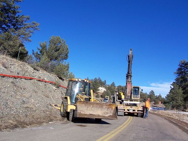
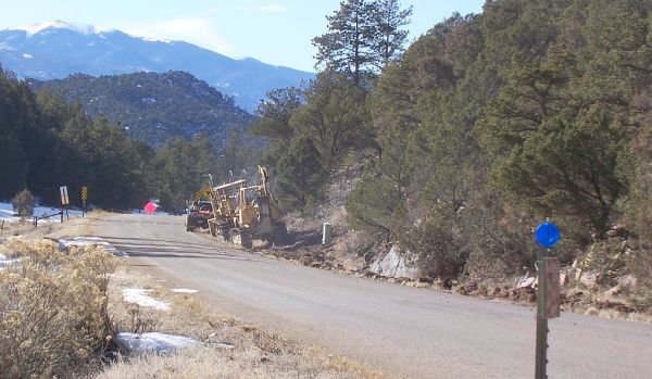
I am impressed with the professionalism the contractor showed. I hope they got adequately compensated for all the extra effort this took! Road Gulch Road is actually in better shape than before the project since some embankments were cut back, improving driver visibility on some curves, not to mention a wider north shoulder.

The entire project was almost 6 miles in length with an elevation drop of 600 feet.

This is the little building where all the phone lines in our neighborhood are terminated; I usually refer to it as the “phone booth”. I once asked a phone worker if I could look inside but he refused. 😦

The fiberoptic line is junctioned in the new terminal box in the right foreground. The county road the cable follows is in the middleground behind the far phone terminal box and the stop sign. The cable goes left along the other side of the road.

When they began, a horizontal boring machine inserted fiberoptic duct under the county road but not all the way to the phone booth. Another hole was later dug across the road and the duct cut off (It extended out into the pasture on the other side of the fence.). The cable was shoved into it after a backhoe trenched from the road to the new junction box then the fiberoptic cable was manually pulled through the duct under the road, laid in the trench, and buried.

I have some scenes from the project but not in any order due to my being “under the weather” this year.

For part of the project, they had to bring The Hammer up from the lower part of the project.

This was just before New Years. I asked if they were gonna finish the project before the end of the year and the “road guard” laughed they would be lucky to finish this part by then! It appeared they used The Hammer while still on the trailer so the pavement would not be damaged. It left its mark along the road.

This is where they stopped for 2011. This is not very far down the hill.

For 2012, they added this tool: a larger backhoe for where the dozers can’t go.

They did restore driveways that they plowed.

Those dozers must have been right against this fence as they passed by!

This is at the cattle guard. The dozers are done and are waiting for a ride home.

This is just above the end and I never did figure out why these were laying on the hill. They later disappeared and no junction box appeared here.

Now that it is done, driving this way is kinda boring again!

Man Eats Food Only Advertised on TV, Becomes Hormonal

While I question use of the word “hormonal” in this article (I would have chosen “lethargic”.), the results are not surprising.

From treehugger:

Sit through any prime-time television show, televised sporting event, or even cartoon and you’re sure to see plenty of commercials for food. And you’ve undoubtedly noticed that this food runs the gamut from fast food pizza and burgers, to snack foods, to sugary breakfast fare. They are really “edible food-like substances,” as Michael Pollan would say.

What would a month of living solely on these TV commercial foods look like? And how would you feel at the end of it?

Tom Lamont, a writer for The Observer, decided to give it a try. For one month, he could only purchase and eat those foods he’d seen advertised on television. As we all well know, this means processed, sugary, salty, fatty food. They don’t advertise Brussels sprouts on television. No bulk whole grains. No pastured meat. Only those products that have a large advertising budget behind them.

Basically, by the time the month was up, Lamont felt like a sluggish, cranky mess. Surprisingly, he didn’t gain any weight, but that could be at least partially because he got so tired of processed foods that he just didn’t eat as much after a while.

Interesting details in the original article, especially how ONE non-junk meal (His girlfriend made him cheat!) made him feel better. Briefly.

Coronal Mass Ejections (CMEs)

What a week for solar activity. TWO large CMEs were hurled at the Earth. This is very unusual. During solar activity maximums, such as we have now, there are about 3/week but rarely aimed at the Earth.

These were not record busters by any means but enough to alter the Earth’s magnetosphere. And being only two days apart, the second one hit while the effects of the first one was still being felt.

#1 “launched” on the 19th and arrived the 22nd. From SpaceWeather for that day:

Arriving a little later than expected, a coronal mass ejection (CME) hit Earth’s magnetic field at 0617 UT on Jan. 22nd. According to analysts at the Goddard Space Weather Lab, the impact strongly compressed Earth’s magnetic field and briefly exposed satellites in geosynchronous orbit to solar wind plasma. Shifting lines of magnetic force induced strong ground currents in Norway

This got my attention! We use Hughes.net for our internet access via a satellite 22,000 miles away. Hughes.net was bought by EchoStar in 2011 and they have a “fleet” of 15 satellites. If the CME damages “our” satellite, we will lose internet access until it is either repaired or a technician re-aims us to another satellite.

We saw little effect on our internet or TV reception (Dish Network, also by satellite).

The second CME hit on the 24th; from SpaceWeather:

As expected, a CME hit Earth’s magnetic field on Jan. 24th at approximately 1500 UT (10 am EST). The impact produced a G1-class geomagnetic storm and bright auroras around the Arctic Circle.

It usually takes a week fro the magnetoshere to recover so this one-two punch had more effect than either alone.

A view from Sweden.

And even an agency in Colorado even had a role to play.

It was a big day at the Space Weather Prediction Center in Boulder because the scientists there once again nailed a forecast, accurately predicting not only the arrival time of the big plasma ball, give or take 30 minutes, but also the relatively modest impact.

Lots more at the Denver Post.

More on historical big CMEs from these sources:

Thursday, September 1, 1859, a 500 year event

March 13, 1989 which caused the Canadian power outage.

My Specialist Ophthalmologist Appointment

I have two ophthalmologists, my regular one in Cañon City and one who is specifically for my macular degeneration in Pueblo. For these appointments, Donna comes along as my designated driver to get home.

This one was the best yet: no Flourescein Angiogram; no eye treatment. So I was soon good to go with “eyes wide open”! I was very dilated so Donna still had to drive.

As I waited for her to go potty, a series of emergency vehicles went screaming by: an ambulance followed closely by a police car went past the end of our street then turned onto the perimeter road to go behind the two medical buildings to the east. Soon a fire truck joined them with two police cars. As we left the parking lot, another police car came down the street but non-emergent. This was a total of six responding units. They all disappeared behind the two big buildings, neither of which have any kind of medical care facility, just offices and labs.

Donna didn’t wanna go see! And there was nothing in the news about this run.

Then we went to Hobby Lobby for Donna to shop.